


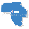
Garland, Hot Spring, Clark & Montgomery Counties PUMA, Arkansas
About
Outline

Summary
| Unique Area Identifier | 192175 |
| Name | Garland, Hot Spring, Clark & Montgomery Counties PUMA |
| State | Arkansas |
| Area (square miles) | 3,039.91 |
| Land Area (square miles) | 2,938.94 |
| Water Area (square miles) | 100.97 |
| % of Land Area | 96.68 |
| % of Water Area | 3.32 |
| Latitude of the Internal Point | 34.35887830 |
| Longtitude of the Internal Point | -93.25019370 |
Maps


Graphs
Select a template below for downloading or customizing gragh for Garland, Hot Spring, Clark & Montgomery Counties PUMA, Arkansas


Neighbors
Neighoring Public Use Microdata Area (by Name) Neighboring Public Use Microdata Area on the Map
- Jefferson, Grant & Arkansas (Northwest) Counties PUMA, AR
- Logan, Polk, Franklin, Sevier, Howard & Scott Counties PUMA, AR
- Pope, Johnson, Yell, Conway & Perry Counties PUMA, AR
- Saline County PUMA, AR
- South Central Arkansas PUMA, AR
- Southwest Arkansas PUMA, AR
Top 10 Neighboring County (by Population) Neighboring County on the Map
- Saline County, AR (107,118)
- Garland County, AR (96,024)
- Hot Spring County, AR (32,923)
- Ouachita County, AR (26,120)
- Clark County, AR (22,995)
- Yell County, AR (22,185)
- Polk County, AR (20,662)
- Grant County, AR (17,853)
- Howard County, AR (13,789)
- Pike County, AR (11,291)
Top 10 Neighboring County Subdivision (by Population) Neighboring County Subdivision on the Map
- Hot Springs township, Garland County, AR (41,479)
- Caddo township, Clark County, AR (22,995)
- Lake Hamilton township, Garland County, AR (20,534)
- Whittington township, Garland County, AR (17,599)
- Hale township, Garland County, AR (16,412)
- Fenter township, Hot Spring County, AR (13,273)
- Marble township, Saline County, AR (4,887)
- Clark township, Pike County, AR (3,662)
- Magnet township, Hot Spring County, AR (2,627)
- Bismarck township, Hot Spring County, AR (2,378)
Top 10 Neighboring Place (by Population) Neighboring Place on the Map
- Hot Springs city, AR (35,193)
- Hot Springs Village CDP, AR (12,807)
- Arkadelphia city, AR (10,714)
- Malvern city, AR (10,318)
- Piney CDP, AR (4,699)
- Rockwell CDP, AR (3,780)
- Glenwood city, AR (2,228)
- Gurdon city, AR (2,212)
- Lake Hamilton CDP, AR (2,135)
- Mount Ida city, AR (1,076)
Top 10 Neighboring Unified School District (by Population) Neighboring Unified School District on the Map
- Bryant Public Schools, AR (46,426)
- Hot Springs School District, AR (30,841)
- Benton School District, AR (28,909)
- Sheridan School District, AR (25,888)
- Lake Hamilton School District, AR (23,990)
- Malvern Special School District, AR (18,325)
- Lakeside School District, AR (17,982)
- Camden Fairview School District, AR (17,872)
- Arkadelphia School District, AR (16,268)
- Fountain Lake School District, AR (14,192)
Top 10 Neighboring State Legislative District Lower Chamber (by Population) Neighboring State Legislative District Lower Chamber on the Map
- State House District 31, AR (39,265)
- State House District 29, AR (38,057)
- State House District 28, AR (32,435)
- State House District 61, AR (29,993)
- State House District 30, AR (29,811)
- State House District 26, AR (29,708)
- State House District 24, AR (29,428)
- State House District 60, AR (28,463)
- State House District 25, AR (27,902)
- State House District 62, AR (27,262)
Top 10 Neighboring State Legislative District Upper Chamber (by Population) Neighboring State Legislative District Upper Chamber on the Map
- State Senate District 22, AR (109,730)
- State Senate District 6, AR (89,072)
- State Senate District 18, AR (85,656)
- State Senate District 4, AR (83,167)
- State Senate District 27, AR (81,170)
- State Senate District 19, AR (78,791)
- State Senate District 20, AR (73,443)
- State Senate District 26, AR (68,899)
Top 10 Neighboring 111th Congressional District (by Population) Neighboring 111th Congressional District on the Map
Top 10 Neighboring Census Tract (by Population) Neighboring Census Tract on the Map
- Census Tract 111, Garland County, AR (8,799)
- Census Tract 112, Garland County, AR (7,634)
- Census Tract 201, Hot Spring County, AR (7,575)
- Census Tract 104, Garland County, AR (7,116)
- Census Tract 105.06, Saline County, AR (6,659)
- Census Tract 105.03, Saline County, AR (6,633)
- Census Tract 105, Garland County, AR (5,965)
- Census Tract 119, Garland County, AR (5,894)
- Census Tract 207, Hot Spring County, AR (5,853)
- Census Tract 116.01, Garland County, AR (5,841)
Top 10 Neighboring 5-Digit ZIP Code Tabulation Area (by Population) Neighboring 5-Digit ZIP Code Tabulation Area on the Map
- 71913, AR (43,436)
- 71901, AR (29,491)
- 72015, AR (27,307)
- 72104, AR (23,354)
- 72019, AR (23,346)
- 71923, AR (15,637)
- 71909, AR (15,508)
- 71953, AR (14,882)
- 71857, AR (5,894)
- 71943, AR (4,821)